-40%
Antique Original Civil War Map Sherman's "March to the Sea" Atlanta to Savannah
$ 39.6
- Description
- Size Guide
Description
Antique Original Civil War Map(Not a reproduction)
Map № 21
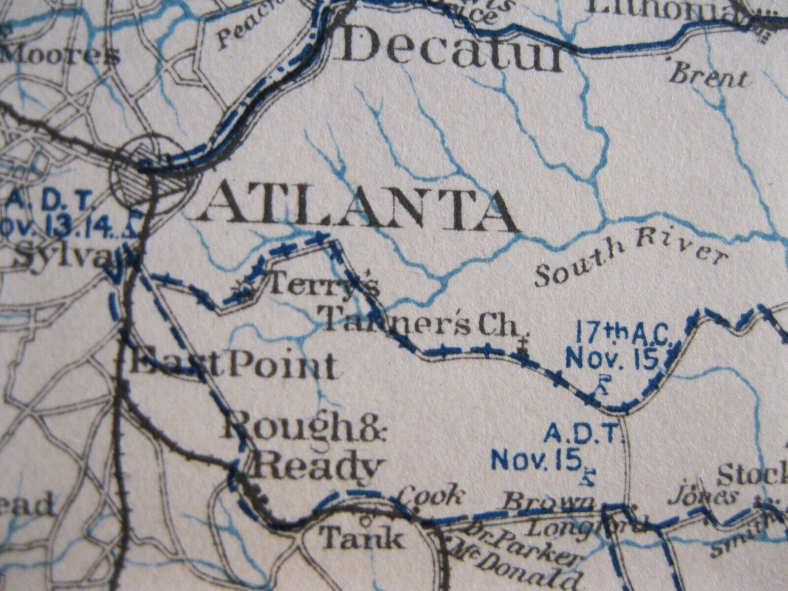
a section taken from Plate CI (101)
"
The Atlas to Accompany the Official Records of the Union and Confederate Armies
"
The March of the Army
under the command of
Maj. Gen W. T. Sherman
Atlanta to Savanah
from
November 15th to December 21st, 1864
This march is historically known as "Sherman's March to the Sea."
William Tecumseh Sherman is acknowledged by many historians as the first modern general.
Now a days he might be said to have fought in an asymmetrical manner. He hated war (and politics) coined the phrase, "War is hell", but when war started it should be made as terrible as possible so it would end as quickly as possible. When he started his march on Nov. 15th he entered behind Confederate lines with limited supplies. His idea was travel light and fast and live off the land and
“forage liberally”; this included stealing crops, livestock, clothing and medicine from civilians and prisoners. His raiding strategy included destroying fields, tearing up railroad tracks (railroad ties were heated and bent around trees rendering them useless and know as "Sherman's Bowties"). The
strategy included
intimidating civilians and freeing slaves to demoralize the population mostly composed of women as most of the men were off fighting the war. This he hoped would put pressure on the men when they learned what was happening to leave the ranks and return home to protect their families.
The fall of
Atlanta in September, it has been said, guaranteed President Lincoln's victory in the 1864 presidential elections. While campaigning across Georgia deep in Confederate territory little information reached the president
as to what was happening. Some historians reported that Lincoln received some information by getting copies of the local southern newspapers. When the army took Savannah on December 22nd, Sherman wired Lincoln, “I beg to present you, as a Christmas gift, the city of Savannah, with 150 heavy guns and plenty of ammunition, and also about 25,000 bales of cotton.”
*****
This detailed map shows the route pursued by each of Sherman's Corps (14th, 15th, 17th & 20th) almost day by day.
A remarkable Civil War document
(Not a reproduction)
taken from Plate CI (101)
of
"The Atlas to Accompany the Official Records of the Union and Confederate Armies":
Commissioned by Resolution of Congress May 19, 1864,
in accordance to serve as the official historical record of the Civil War.
(The complete Plate CI shown in the photo is not part of the sale but only to document the source of the map)
The Atlas from which this plate was taken was never publicly sold but exclusively distributed to federal depositories, universities, museums and various public institutions until they were withdrawn from these institutions and entered the public domain years later.
The atlas still remains the definitive source of Civil War information available.
It was published between
1891
and
1895
.
Plate section size: 29.5" x 6.3"
Map image: 27.4" x 6.3"
****
This map is
a impressive addition to any collection of
Antiques
Maps
Civil War History
or
Research


